Construction Intelligence
Los Angeles opens a new zoning chapter for the Southwest Valley
LA’s Southwest Valley draft plans target housing and commercial growth. Public review runs through November 22, with parcel-level changes to watch.

Los Angeles opens a new zoning chapter for the Southwest Valley
City of Los Angeles | October 20, 2026
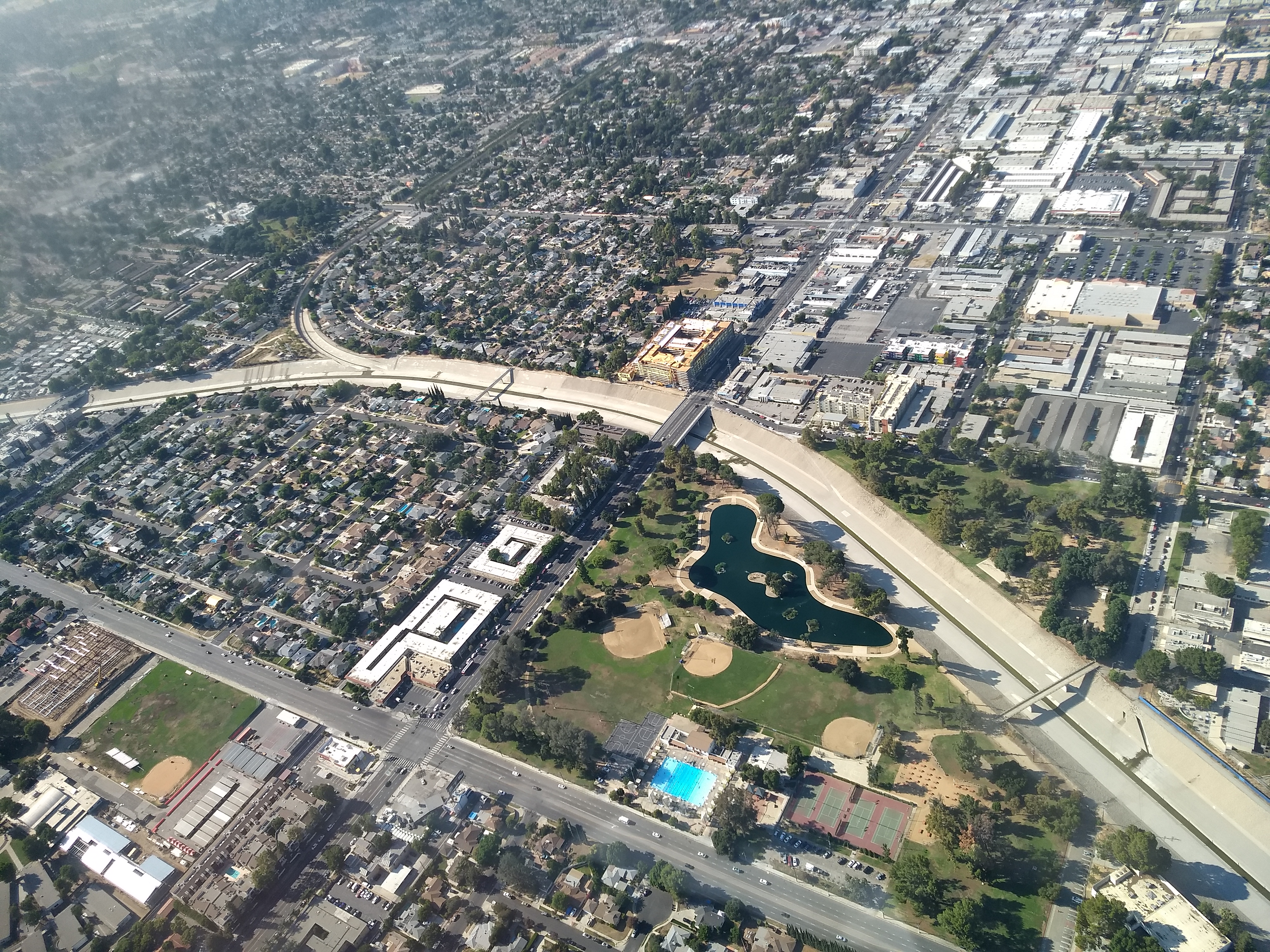
Reseda Boulevard crosses the Los Angeles River beside Reseda Park in this September 2, 2019 aerial photograph. Archival neighborhood context only; it does not depict construction authorized by the proposed 2026 Southwest Valley plans. Photo: Eric Shalov / Wikimedia Commons, CC BY-SA 4.0. Image unmodified.
Los Angeles has put the next version of its Southwest Valley development rules into public review, giving residents and construction teams a clearer view of where future housing and commercial activity could concentrate. The City released a draft environmental impact report on October 8. The review package includes updated land-use maps, zoning proposals and policy documents. Comments are due November 22, 2026, at 5 p.m. [2]
The update covers three community plans: Canoga Park–Winnetka–Woodland Hills–West Hills, Encino–Tarzana and Reseda–West Van Nuys, which would gain Lake Balboa in its name. The proposed framework looks ahead to 2050. It would apply the City's new zoning code across the plan areas, making this a broad change in the rules behind individual projects rather than an announcement of one development. [1]
Where the draft directs growth
The City's fall 2026 “Areas of Change” handout identifies targeted areas where proposed height, floor-area or density allowances would increase. These include portions of Ventura Boulevard, Downtown Canoga Park, the Reseda Central Business District and the area around the Reseda Metro G Line station. In many other locations, the City says the new zoning would generally carry forward existing uses and potential building envelopes. [3]
The draft also proposes modest density increases along some major streets lined with low-rise homes and rear-alley garage access. The City's examples of the intended housing forms include townhomes, small-lot homes and courtyard buildings. Those concepts offer a more specific picture of possible infill activity, but the parcel-level maps and eventual adopted standards will determine what a particular site can support. [3]
Commercial work remains part of the picture
The employment strategy seeks to preserve and improve industrial sites while supporting neighborhood-serving businesses. A separate City handout describes proposed limits on the size of new commercial tenant spaces as one way to support smaller businesses. For contractors, this is a reason to follow commercial interiors and mixed-use ground floors alongside the housing discussion. It is an editorial inference about potential work, not a forecast of signed leases or construction volume. [4]
The environmental review also identifies significant, unavoidable effects, including construction air pollution, noise and vibration. These are findings about the proposed planning program; they do not establish the impacts or mitigation requirements of every future building. Site-specific constraints and subsequent approvals still matter. [1]
What construction teams can do now
The useful near-term step is to compare a prospective property's current rules with the City's draft interactive map. Architects, developers and builders should identify proposed changes to use, height, floor area, frontage and site layout before assuming that a familiar zoning label carries the same development potential. [2, 3]
Civil and building contractors can then ask a focused question: would the proposed envelope change the likely building type, access arrangement or site-work scope? Answering that requires a real parcel and a design, not just a corridor name.
The public review is still underway. The notice states that the plans themselves would not directly entitle or construct new development; later projects would need additional approvals. The City will announce the project hearing separately. [2] Until adoption and project-level decisions occur, the maps are a planning signal rather than an available bid pipeline. [1]
Explore BuildDetect's Los Angeles project and permit guide for help comparing planning cases with building records. Project search requires sign-in and product access; coverage is partial. [5]
Sources
- [[1] City notice of availability • October 8 2026](https://planning.lacity.gov/EIR/Southwest_Valley_CPU/DEIR/Sections/Notice_of_Availability_Southwest_Valley_Community_Plans_Update_DEIR.pdf)
- [[2] City draft-plan materials and comment instructions](https://planning.lacity.gov/node/133316)
- [[2] City draft EIR page • hearing and deadline instructions](https://planning.lacity.gov/development-services/eir/southwest-valley-community-plans-update-0)
- [[3] City Areas of Change handout • Fall 2026](https://planning.lacity.gov/odocument/70c11976-08e4-40b9-8f06-1388e3b5ca98/Areas_of_Change.pdf)
- [[4] City Jobs and Economic Development handout • Fall 2026](https://planning.lacity.gov/odocument/9ff97e6a-a81e-45fa-9370-09b14eba8532/Jobs_and_Economic_Development.pdf)
- [[5] BuildDetect Los Angeles project and permit guide](https://builddetect.com/media/los-angeles-permit-search)